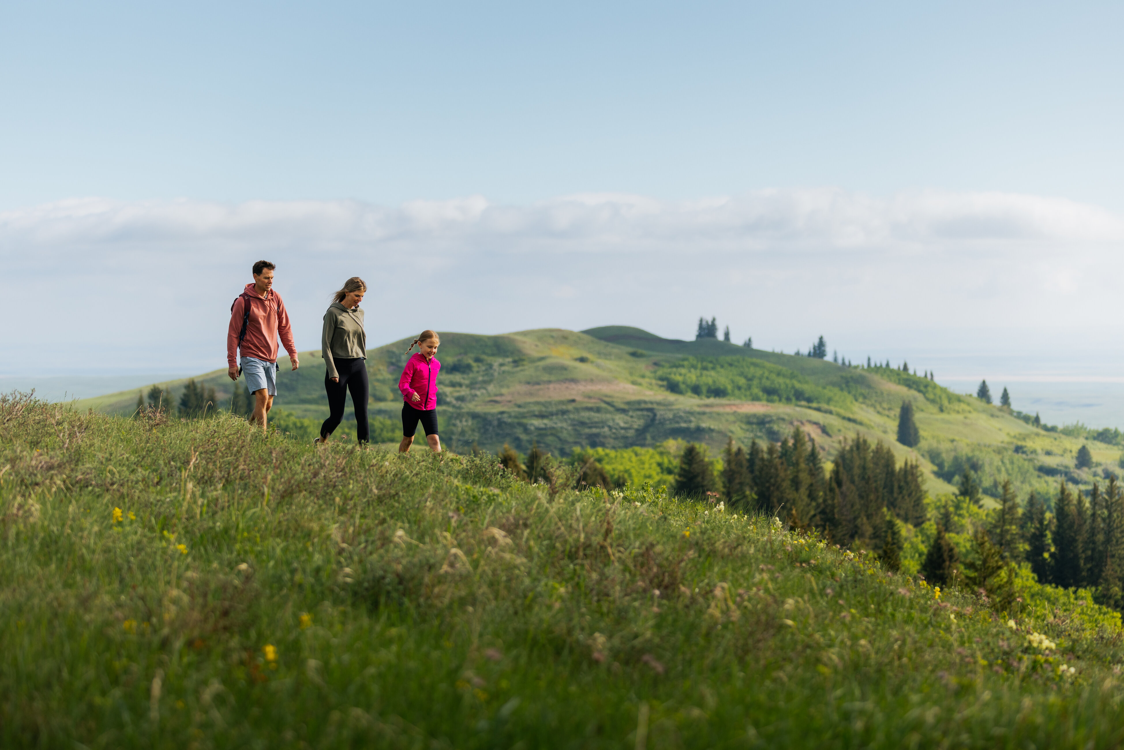
Medicine Hat doesn't get enough credit for its trails. The city sits in a river valley with coulees cutting through it in every direction and over 190 kilometres of connected pathways snake through parks, along the South Saskatchewan River, and up into the hills. Whether you're after a casual family walk or a longer haul with real elevation, here's where to go.
Police Point Park — The Best All-Around Trail in the City
Difficulty: Easy | Distance: 3–5 km depending on route
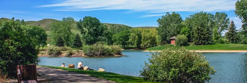
Police Point Park is the most popular trail destination in Medicine Hat, and it earns it. The 97.7-hectare riverfront park on the north side of the city has a maze of interconnected paths running through forest and along the South Saskatchewan River, with wildlife sightings deer, birds, the occasional coyote — being genuinely common.
The outer perimeter loop is the most popular route, but there's enough trail variation inside the park to keep it interesting on repeat visits. A nature centre on-site runs interpretive programs year-round. Dogs are welcome on leash, and there's a dedicated off-leash trail with river views directly connected to the main network. Trails are maintained in winter for snowshoeing and cross-country skiing too.
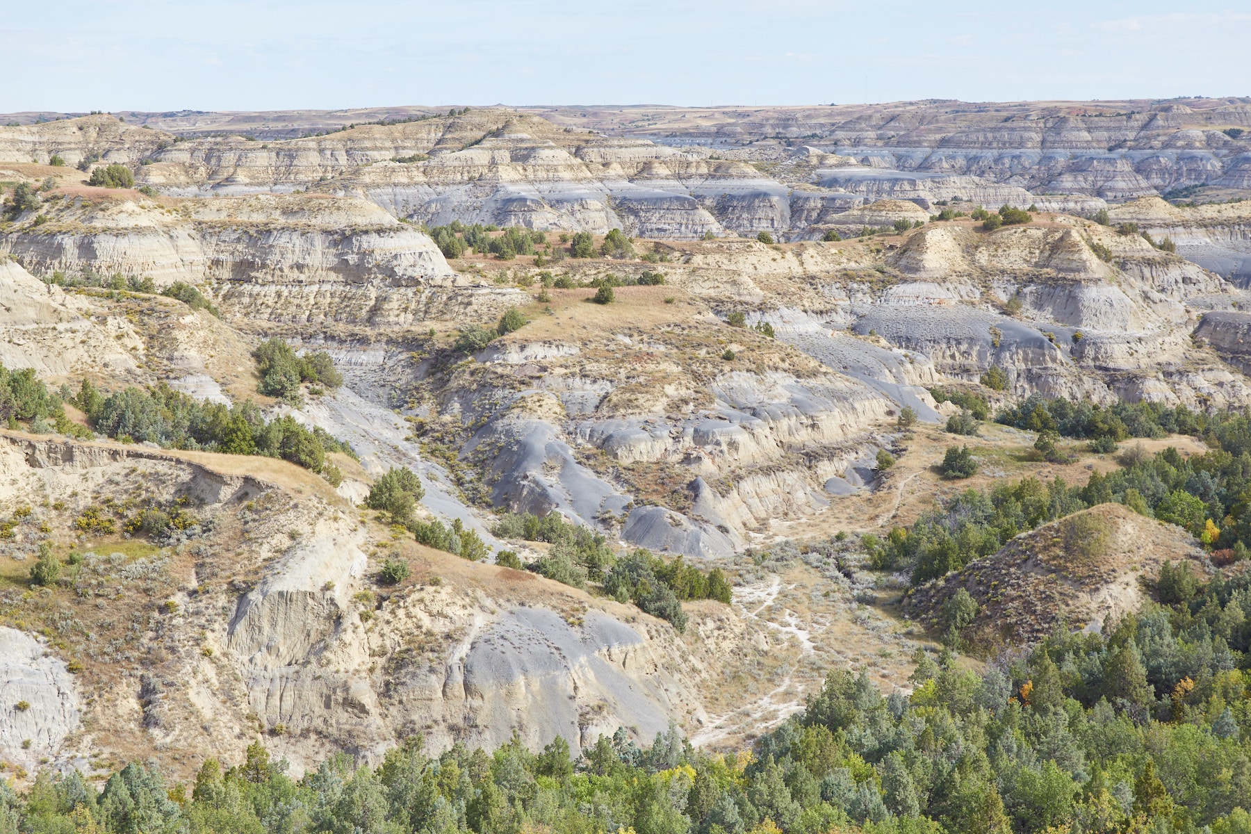
Echo Dale Regional Park — Red Cliffs, River Views, and a Historic Farm
Difficulty: Easy to Moderate | Distance: 3–15 km
Echo Dale sits about 12 minutes west of the city and pulls over 110,000 visitors a year most of them there for the beach. But the trail system here is genuinely good and often overlooked.
The paved and gravel paths wind through 255 hectares of coulees and river valley, with the highlight being the views of the red sandstone cliffs across the South Saskatchewan. The short in-park loops are easy and flat, accessible for all ages. The Echo Dale to Gas City Campground trail extends the outing considerably 9.7 kilometres one way with 793 feet of elevation gain, making it the longest and most challenging trail in the city's network.
The historic farm on the park's west end is worth walking through it's an active pioneer-era site with original buildings dating to the late 1800s.
Crescent Heights Coulee Trail — Best View in Medicine Hat
Difficulty: Easy to Moderate | Distance: Varies
Up on the north side coulee in Crescent Heights, this trail rewards you with a panoramic view of Medicine Hat that most residents have never stopped to take in Historic Downtown laid out below, and on a clear day, the rolling hills of Cypress Hills visible in the distance. Short enough to do in under an hour, dramatic enough to be worth the drive.
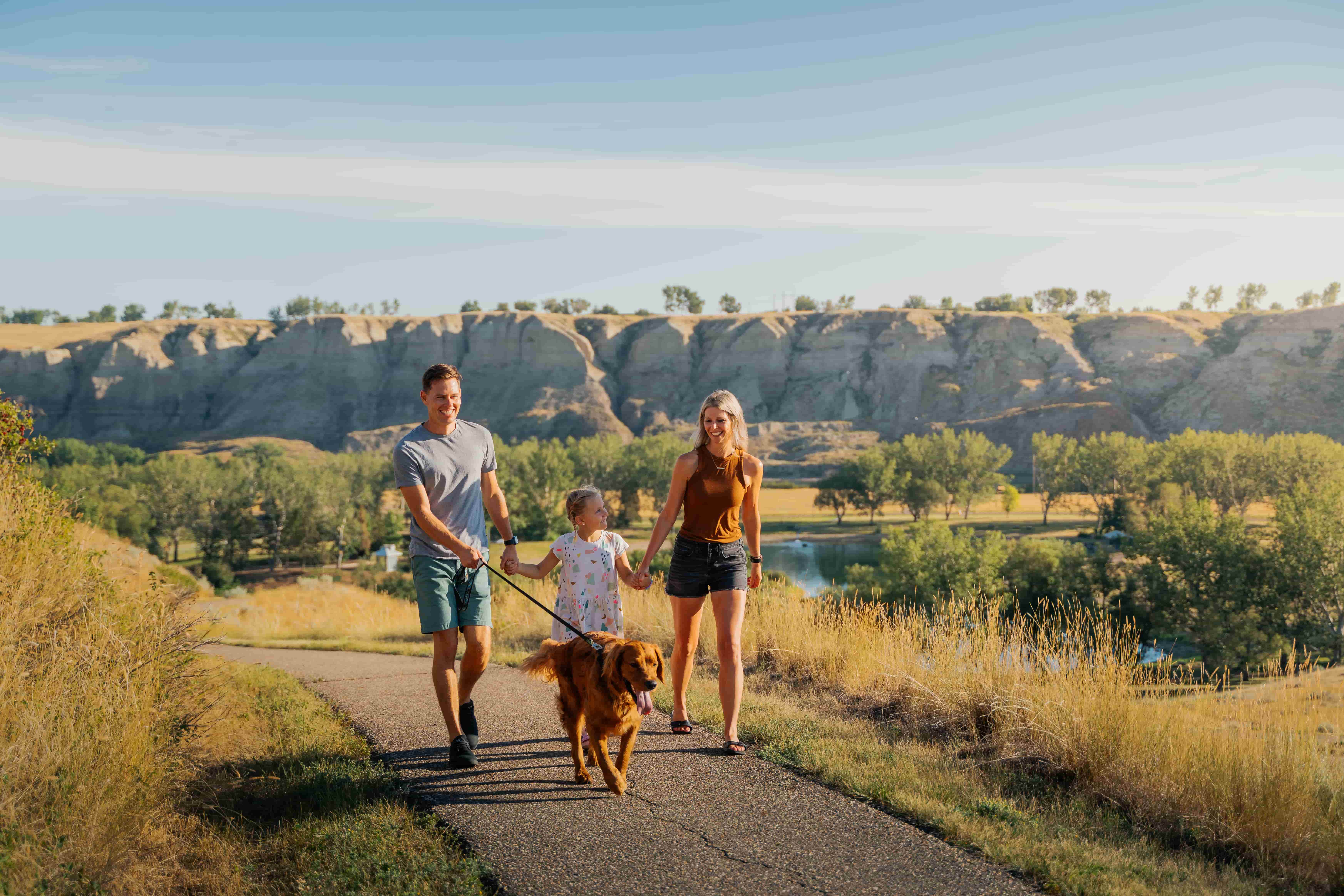
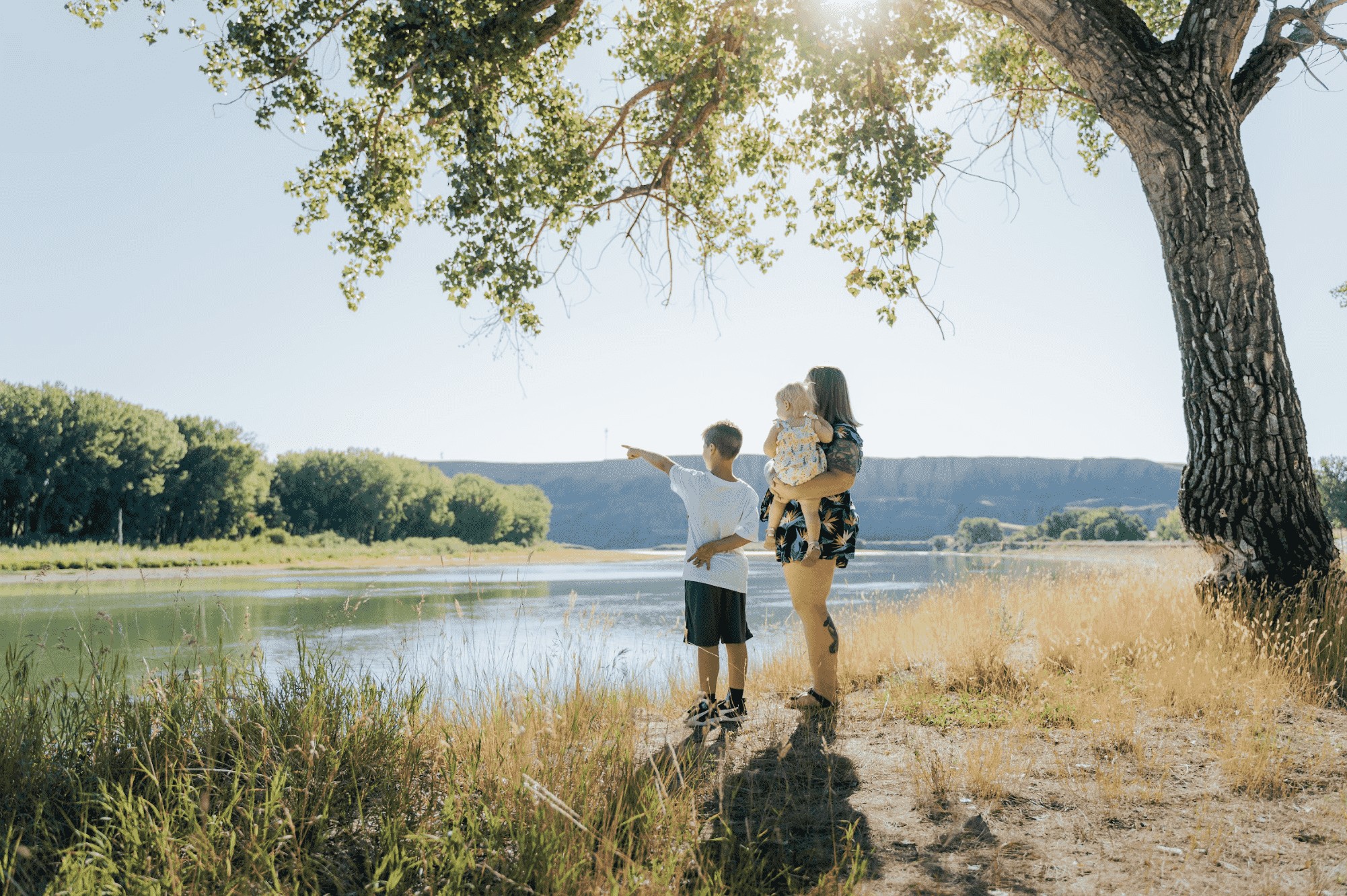
Strathcona Island Park and Devonian Trail — Best River Walk
Difficulty: Easy | Distance: 4–8 km
A paved riverfront trail along the South Saskatchewan, this is Medicine Hat's most popular route for runners, cyclists, and people walking dogs. Strathcona Island Park anchors the route with shaded tree cover for most of the way, and the loop can be extended to connect with the Devonian Trail and across the Finlay Bridge a truss bridge built in 1908 that's worth stopping on.
Parking is easy at Strathcona Island Park near the YMCA. Connects into Medicine Hat's broader Heritage Trail Network, so you can extend the route in almost any direction.
Cypress Hills Interprovincial Park — Best Day Trip for Real Hiking
Difficulty: Moderate | Distance: Multiple trails, 3–15+ km
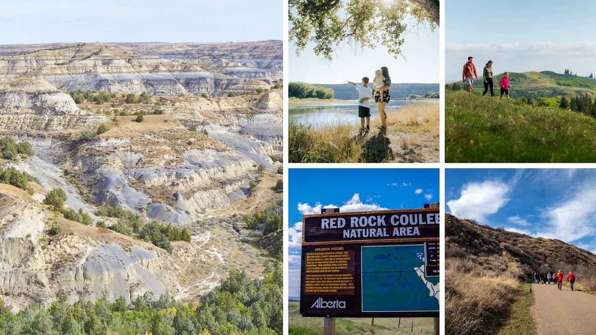
About an hour south of Medicine Hat on Highway 41, Cypress Hills is where you go when you want elevation, trees, and actual wilderness. The Spruce Coulee Trail System has three trails ranging from a couple of kilometres up to longer full-day routes. The landscape is completely different from the surrounding prairies dense forest, rolling hills, wildlife corridors and it's consistently rated as one of the best hiking destinations in Southern Alberta.
This is the option for anyone visiting Medicine Hat who wants a proper hike rather than a trail walk.
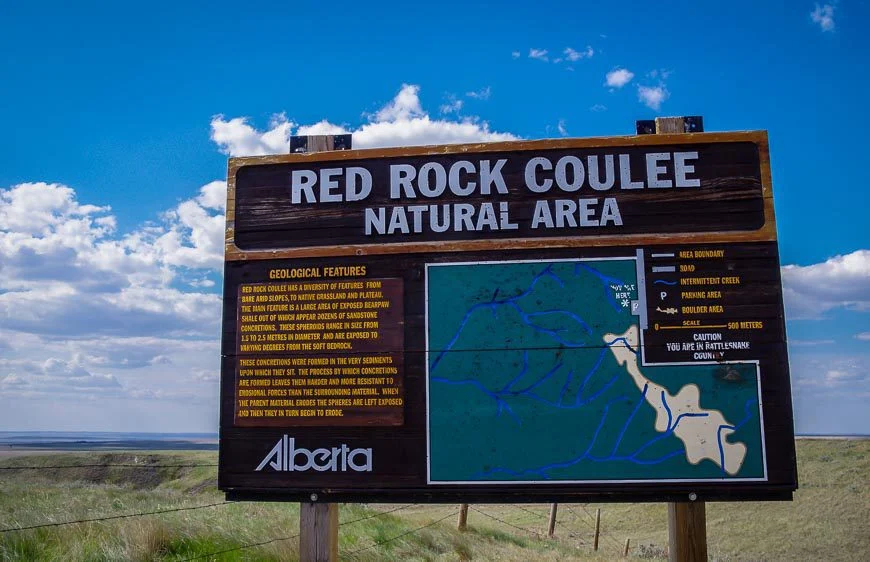
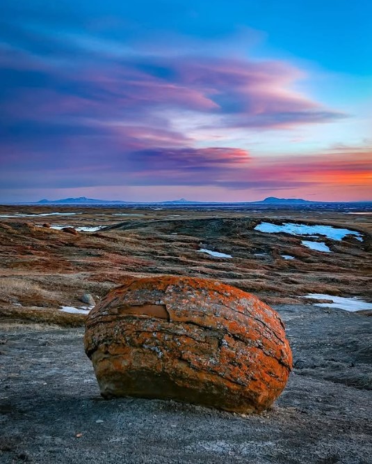
Red Rock Coulee Natural Area — Otherworldly and Worth the Drive
Difficulty: Easy | Distance: 2–3 km
Not a maintained trail system, but worth knowing about. About 35 minutes south of Medicine Hat, Red Rock Coulee is 324 hectares of badlands with massive red sandstone concretions scattered across the landscape some up to three metres in diameter. It looks like another planet. There's minimal signage, no facilities, and no crowds. Bring water and a camera.
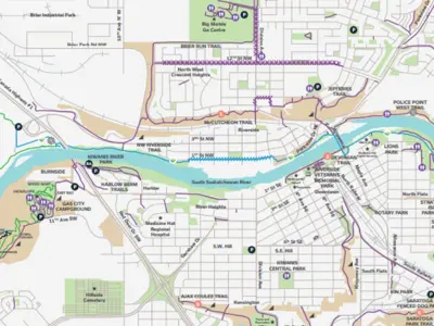
The Heritage Trail Network — The Full Picture
All of Medicine Hat's in-city trails connect into the Heritage Trail Network, which spans roughly 190 kilometres across the city. Paved and accessible throughout, it links Police Point, Echo Dale, Strathcona Island, Kin Coulee Park, Ross Glen Coulee, and dozens of neighbourhood connectors. If you're staying in Medicine Hat for more than a day, pick up the trail map at the Visitor Information Centre downtown and plan a multi-leg route.
Sources
Tourism Medicine Hat — Trails: tourismmedicinehat.com/features/must-explore-trails
Tourism Medicine Hat — Echo Dale: tourismmedicinehat.com
AllTrails — Medicine Hat: alltrails.com/canada/alberta/medicine-hat
Cypress Hills Interprovincial Park — Alberta Parks: albertaparks.ca