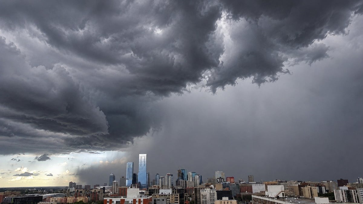
A powerful band of thunderstorms is sweeping across the Edmonton region tonight, and the most intense part of it is sitting right over the western communities.
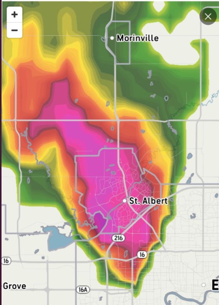
Radar the evening of July 10 showed the storm's heaviest core over St. Albert and pushing east toward Edmonton, with heavy returns stretching back through Spruce Grove and Stony Plain to the west and up toward Morinville to the north. Environment Canada warns the strongest cells can bring large hail, damaging winds, and torrential rain, with an isolated tornado not ruled out. The cells are moving fast, so warnings are being issued and expiring within the hour. The most reliable thing you can do tonight is check the alert for your own community.
Which communities are in the path
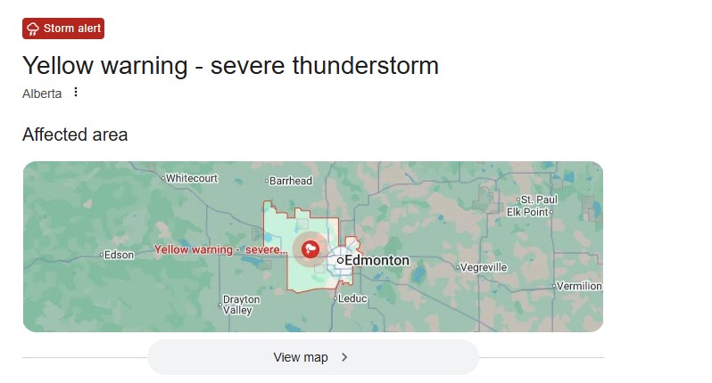
The storm is hitting the western and northern parts of the Edmonton region hardest as it tracks through.
St. Albert took the most intense part of the core, heavy rain, the highest hail risk, and the strongest wind. Spruce Grove and Stony Plain, just west, sat in the line of the storm as it moved through. Morinville, to the north, fell under the heavier returns too. And the city of Edmonton, along with Sherwood Park and the rest of the metro to the east, is next in the storm's path as it moves that way.
If you're in any of these communities, this is the window to get inside, move vehicles under cover if you can, and keep your phone close for alerts.
What the storm can bring
The main threats are large hail and strong winds. In the strongest cells, Environment Canada and forecasters have flagged hail up to golf-ball size and wind gusts that can reach 100 km/h, enough to crack windshields, dent vehicles, damage roofs and trees, and knock out power. Heavy downpours can flood low spots and drop road visibility to almost nothing in minutes.
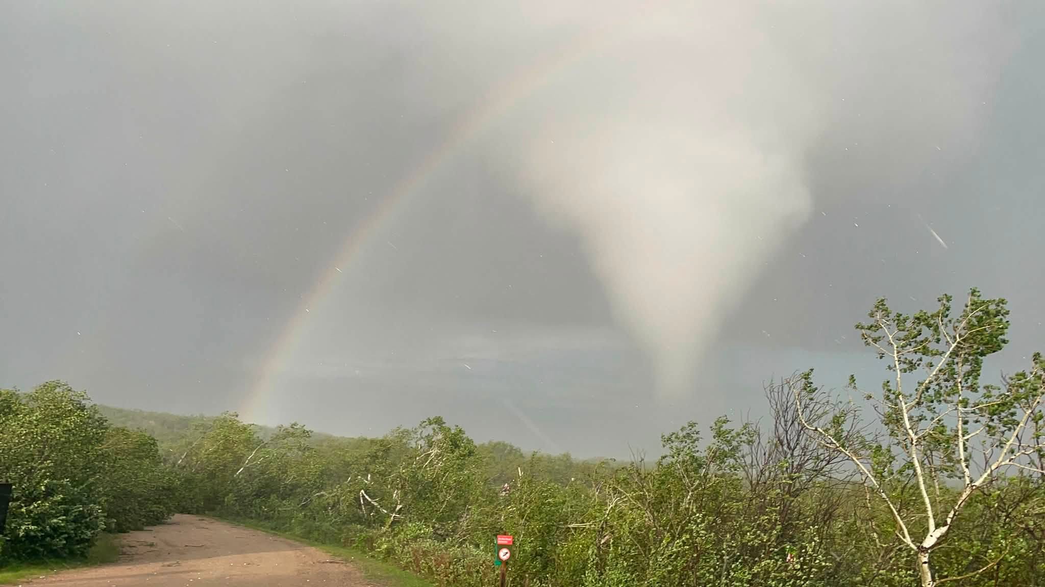
An isolated tornado can't be ruled out either. The same atmospheric setup that's spun up tornadoes across central Alberta all week is still in place. For the Edmonton area tonight, the hail and wind are the bigger threat, but the tornado risk isn't zero.
What to do right now
If a severe thunderstorm or tornado warning is issued for your area, get indoors and away from windows, and move to the lowest floor if a tornado is possible. Driving into large hail? Pulling over somewhere safe usually beats pushing through it. Getting your vehicle under cover before the core arrives can save you a serious hail-damage bill.
Storms can outrun the alerts, so it helps to read the sky. A greenish tint to dark clouds often means heavy hail. A sudden hard shift in wind can mean the storm's leading edge is right on top of you. A low, rotating wall of cloud is the one to act on immediately, don't wait to see a funnel.
A week of storms across Alberta
Tonight is the latest in a stretch of near-daily severe weather across the province.
On July 8, two confirmed tornadoes touched down in east-central Alberta. One tore through the Dillberry Lake Provincial Park campground, flipping trailers and sending three people to hospital. The park is closed indefinitely while crews assess the damage and restore power, and all affected camping reservations have been cancelled and refunded. Tornado warnings have since hit Barrhead, Ponoka, Parkland, and Yellowhead counties.
The numbers behind the season are striking. The Northern Tornadoes Project has recorded 57 tornadoes across Canada so far this year, 46 of them on the Prairies. Its director says the country hasn't seen a season this active this early since the 1980s.
What comes next: the heat flips on
There's a sharp turn coming. As this storm system finally pushes east into Saskatchewan, a heat dome building over the United States is set to spread across the southern Prairies this weekend, swinging Alberta from severe storms to soaring temperatures in a matter of days.
How to stay informed
Alberta Emergency Alert pushes the most serious warnings straight to your phone, and weather.gc.ca has the live watches and warnings for your exact location, the fastest way to know if a cell is about to hit your neighbourhood. If you see severe weather, Environment Canada takes reports at 1-800-239-0484 or on X with the hashtag #ABStorm.
This is a developing situation. We'll update as conditions change.
Sources:
Environment and Climate Change Canada, severe thunderstorm and tornado warnings for the Edmonton region and central Alberta, July 10, 2026 (weather.gc.ca)
Alberta Emergency Alert (emergencyalert.alberta.ca)
Alberta Parks, Dillberry Lake Provincial Park closure, statement from Katy Delves
Northern Tornadoes Project, Western University, 2026 season tornado counts







Comments
Conversation