
Roads east of Calgary are covered in hail.
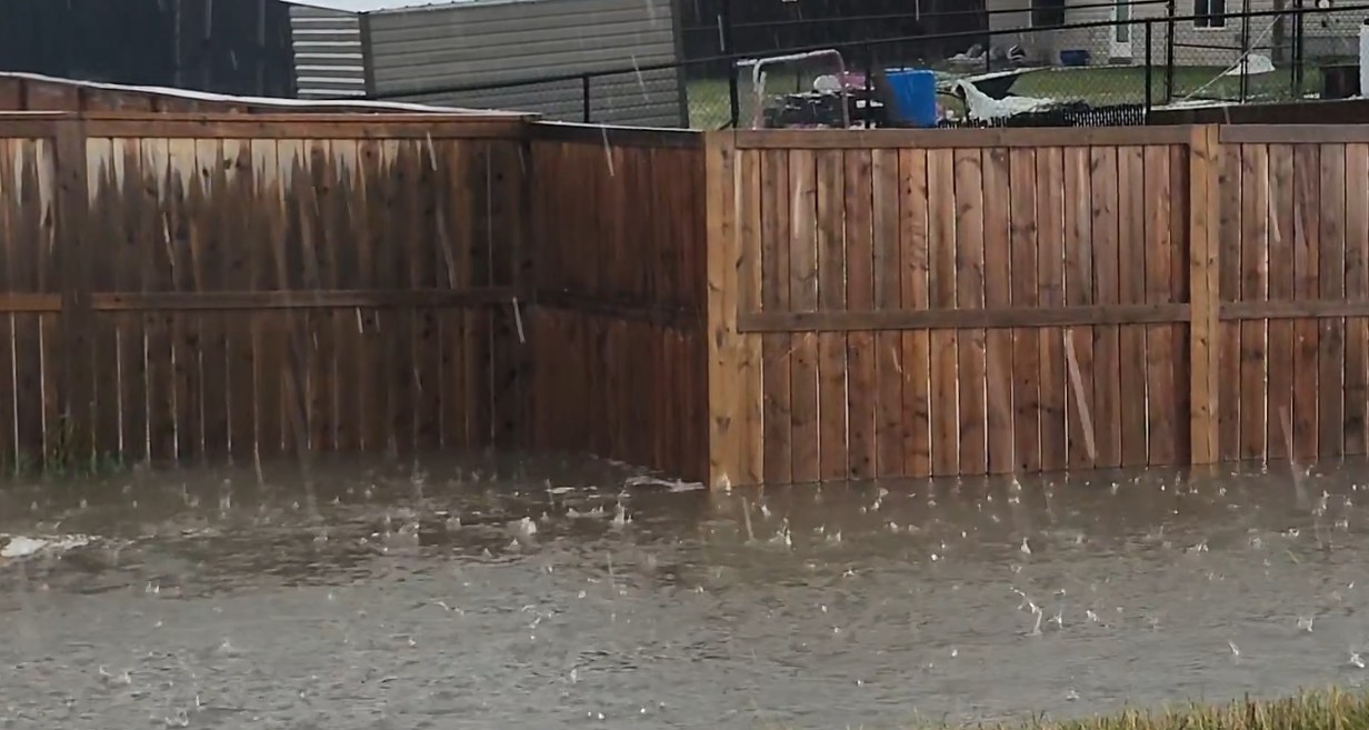
Storm observers reported treacherous conditions near Langdon around 4:10 p.m. Sunday, describing large amounts of small hail on the roads, ditches full, culverts gushing, and localized flooding caused by training storms.
Environment Canada had a severe thunderstorm warning in effect for the corridor east of the city, covering Chestermere, Langdon, Indus, Dalemead and the Delacour area.
Calgary itself was under a yellow watch rather than a warning.
What "training storms" means
It's the reason the flooding is happening, and it's a term worth knowing.
Training describes storm cells moving repeatedly over the same ground, one after another, like railcars passing a fixed point. Each cell might not drop an extraordinary amount of rain on its own, but four or five in succession over the same fields and roads produce totals the ground can't absorb.
That's why ditches fill and culverts gush in a storm that doesn't look dramatic on radar. The problem is duration rather than intensity.
Where the storms were
East of Calgary, through Chestermere, Langdon, Indus and Dalemead, is where the hail and flooding reports came from.
South of Calgary is where radar showed the strongest cells, over the High River area and running south through Nanton, Vulcan, Stavely and Claresholm toward Fort Macleod.
Calgary proper saw scattered lighter returns, with the main activity passing to the east and south.
Alerts change quickly. Check weather.gc.ca for your exact location, or use Alberta Emergency Alert.
If you're driving
Hail on a road behaves like ice. Braking distance increases substantially and vehicles lose traction on corners at speeds that felt fine a minute earlier. Slow down well before you think you need to.
Don't drive through water on a road. Water pools deeper than it looks, especially on rural sections where the shoulder drops into a ditch. A road that seems passable can stall a vehicle.
The highways east and south of Calgary have full ditches right now, which means the margin for error at the road edge is gone.
Road conditions are at 511.alberta.ca, through the 511 app, or by dialling 511 in Alberta.
Chestermere and Langdon have been here before
Both communities have a history with exactly this kind of storm.
In July 2015, a thunderstorm tracking east out of Calgary caused flash flooding in Chestermere and Langdon, filling basements and knocking out power. Chestermere's director of emergency management at the time described it as an intensely severe storm that brought an amount of water that overwhelmed the city's systems. A Langdon resident said his sump pit filled faster than he could vacuum it out.
Chestermere took a second storm two days later and applied to the province for flood assistance, after the first one damaged more than 300 homes.
More recently, a fast-moving storm in July 2025 brought golf ball hail and winds above 90 km/h through Calgary before hitting Chestermere and Langdon and dissipating in Vulcan County.
The same system hit Saskatchewan
This is a large system moving east across the Prairies.
The same day brought a tornado, heavy rain and severe thunderstorms to southern Saskatchewan. Environment Canada expects the severe thunderstorm risk there to end as storms move into Manitoba Sunday evening, with rain continuing into Monday.
Wind is the next concern. Environment Canada anticipates gusts of 90 to 100 km/h across southern Saskatchewan on Monday, with additional wind warnings expected.
Report what you see
Environment Canada takes public severe weather reports at ABstorm@ec.gc.ca, by phone at 1-800-239-0484, or on social media with #ABStorm.
Hail size, flooding depth and wind damage reports all help confirm what radar can only estimate. Report only from a safe location.
Send us your photos and video too, with the time and where you were standing. We'll add them to this story.
Sources
Environment and Climate Change Canada, severe thunderstorm watch for southern Alberta and warning for areas east of Calgary, August 30, 2026
Alberta 511









Comments
Conversation