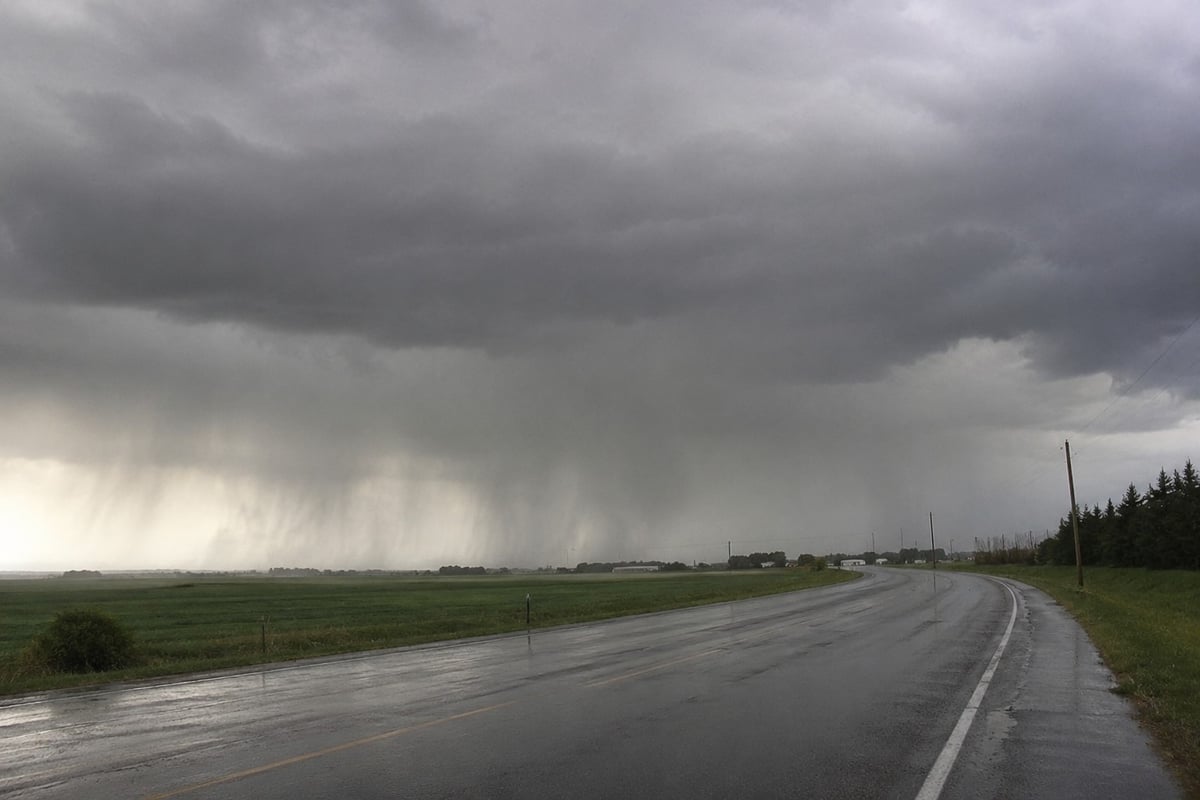
Southern Alberta is in for a wet week.
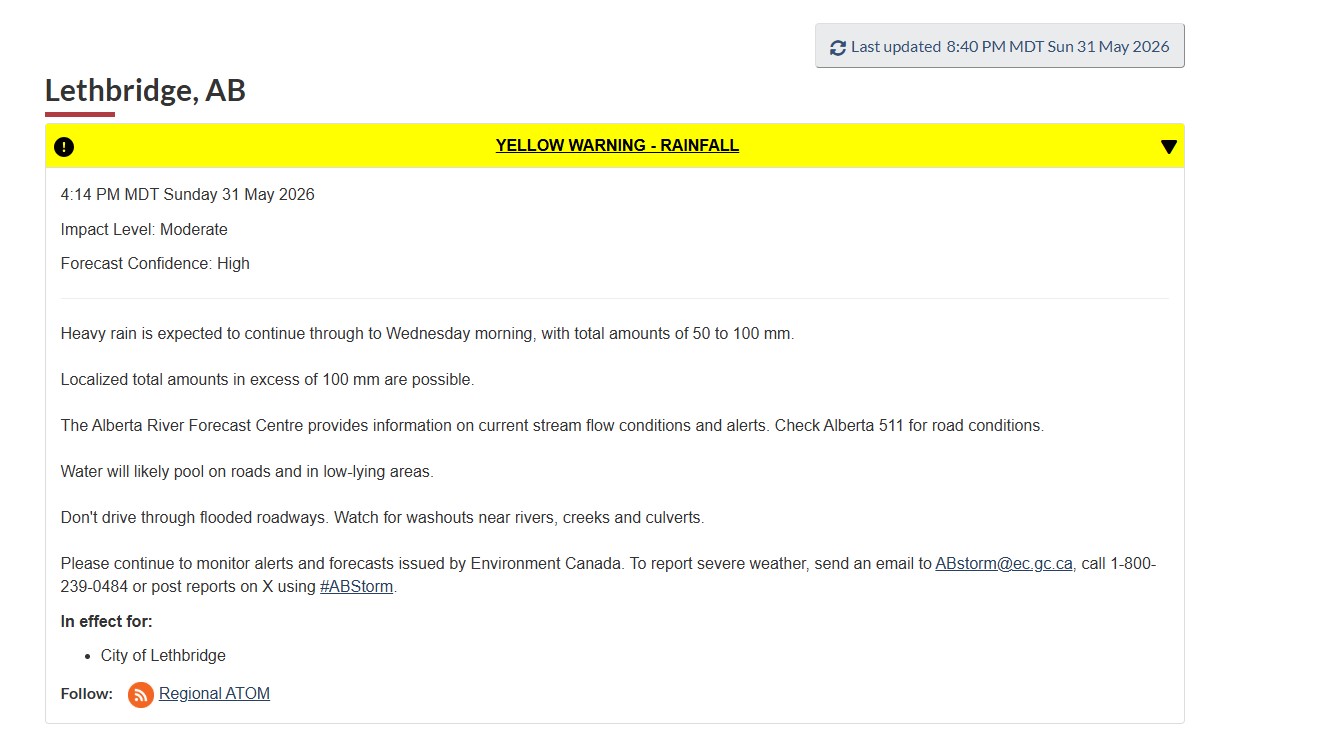
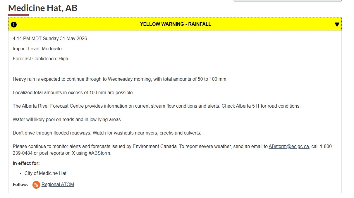
Environment Canada issued a rainfall warning for the region Sunday covering Lethbridge, Medicine Hat, and communities across the south. Heavy rain is expected to continue through Wednesday morning with total amounts of 50 to 100 mm. Localized totals above 100 mm are possible.
For context: Medicine Hat averages 43.8 mm of precipitation for the entire month of May. Lethbridge averages around 47 mm. This system is delivering more than a full month's worth of rain in under five days.
Monday and Tuesday are the heaviest days. After Tuesday conditions gradually improve with drier weather returning later in the week.
What to expect on the roads
Water will pool on roads and in low-lying areas across both cities and surrounding communities. Underpasses, drainage channels, and areas near coulees are the first places to watch.
Do not drive through flooded roadways. Water depth is impossible to judge from inside a vehicle and moving water can push a car faster than most people expect. Watch for washouts near rivers, creeks, and culverts. Gravel roads and rural routes across southern Alberta are particularly vulnerable as ground becomes saturated through Monday and Tuesday.
Check Alberta 511 at 511.alberta.ca before driving highway routes. Road conditions are being updated in real time.
The rivers to watch
The Oldman River downstream of the Oldman Reservoir to the Saskatchewan River confluence is under a high streamflow advisory. The Waterton River below Waterton Reservoir to the Belly River is also being monitored. The Milk River basin in southeastern Alberta is under a high streamflow advisory as well.
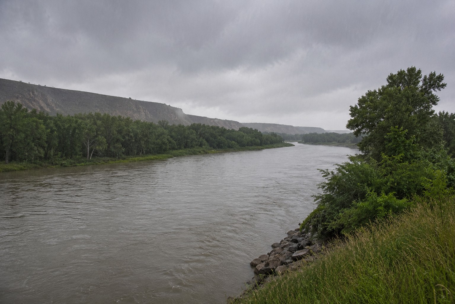
For Lethbridge, the Oldman River running through the coulee bottom is the primary concern. The coulees and river valley trails will be slippery and unstable as rain saturates the soil. Anyone walking trails through the coulees or near the river bottom should stay away until conditions improve after Wednesday.
For Medicine Hat, the South Saskatchewan River and Seven Persons Creek are both being monitored. The city's river valley parks and pathways along the South Saskatchewan are likely to see rising water levels through Tuesday. Medicine Hat recorded 77.3 mm in a single day in May 2024 shattering its previous May record by more than 30 mm. This system is slower and sustained, meaning accumulations build gradually rather than arriving all at once.
This is not an isolated event
The same system pushing rain into southern Alberta is hitting most of the province simultaneously. Environment Canada has issued rainfall warnings from Fort McMurray in the northeast all the way to Lethbridge in the south. Calgary is managing rising Bow and Elbow River levels. Banff and Canmore are urging people off riverbanks entirely.
Southern Alberta sits at the end of this system's track which means some of the moisture that has already fallen further north will work its way into rivers draining south before the week is out.
What to do right now
Stay off river trails and valley paths in both cities. Do not drive through flooded roads. Keep drains clear around your property. Check on neighbours in low-lying areas.
For current river levels and streamflow advisories: albertariverforecast.ca
For road conditions and highway closures: 511.alberta.ca
For the latest Environment Canada warnings: weather.gc.ca
To report severe weather: email ABstorm@ec.gc.ca or call 1-800-239-0484

Sources:
Environment Canada — Rainfall Warning, City of Lethbridge, May 30-31, 2026 (weather.gc.ca)
Environment Canada — Rainfall Warning, City of Medicine Hat, May 31, 2026 (weather.gc.ca)
Alberta River Forecast Centre — High streamflow advisories, May 31, 2026 (albertariverforecast.ca)