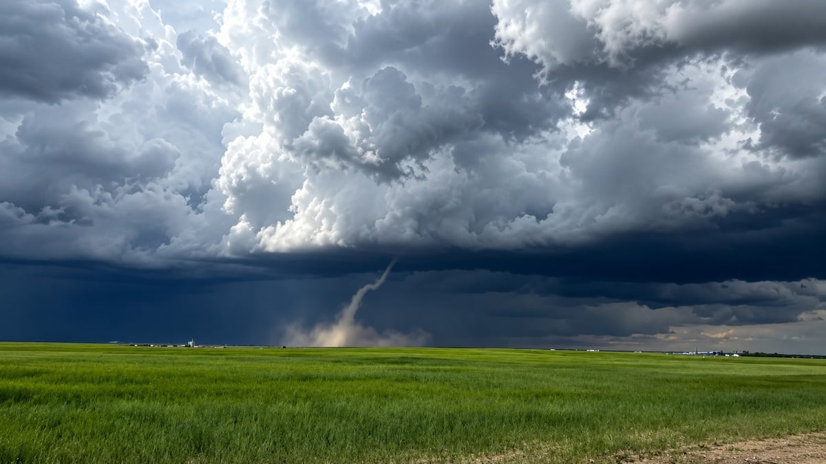
A tornado warning is in effect for east-central Alberta near the Saskatchewan border, and the storm behind it is moving toward Lloydminster.
Environment Canada issued the warning the evening of July 8 through the Alberta Emergency Alert system. At 7:22 p.m. MDT, meteorologists were tracking a severe thunderstorm near Paradise Valley that may be producing a tornado. A funnel cloud has already been reported with the storm.
To be clear on the geography: the tornado warning covers Paradise Valley and the surrounding County of Vermilion River, not the city of Lloydminster itself. But the storm line is pushing east directly toward Lloydminster, which is why people in the city need to be paying attention right now.
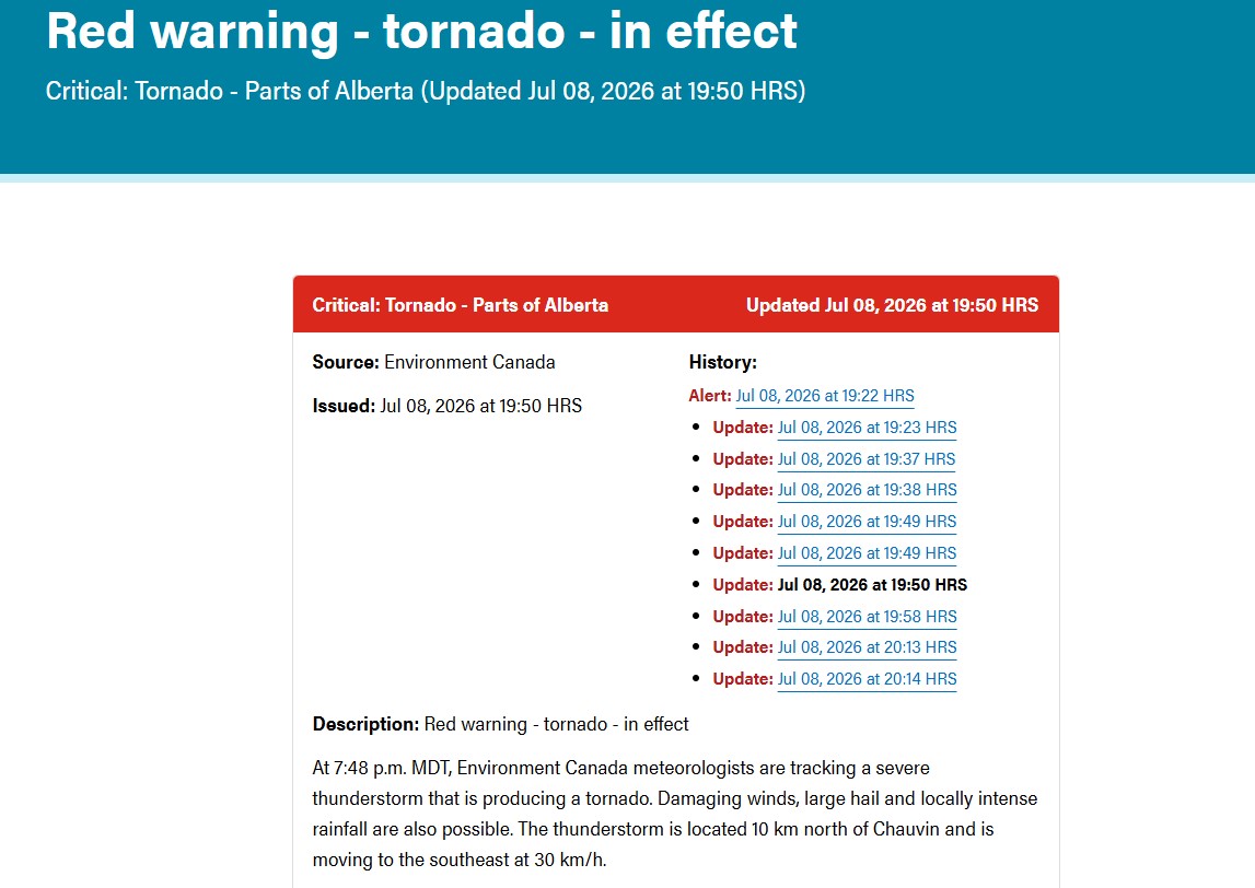
If the storm is coming your way, get inside now
Don't wait to see it. Get to a basement, an interior room, or a sturdy shelter. If you can't get indoors, lie flat in a low spot and cover your head against flying debris. If you're on the water, head to shore and seek shelter if there's any chance of making it, otherwise move away from the tornado's path, wear your lifejacket, lie face down, and protect your head. A tornado warning means one is either forming or already on the ground, so the time to move is now, not when it comes into view.
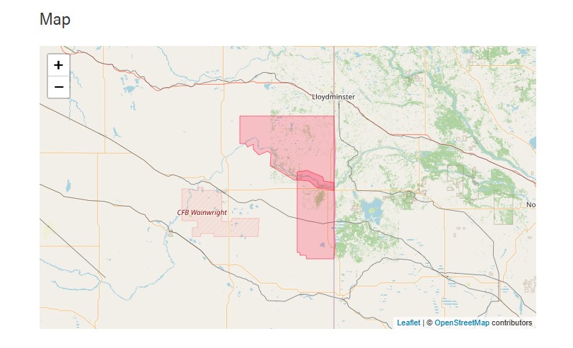
Where the storm is and where it's headed
The warning covers the County of Vermilion River near Paradise Valley, along with parts of the M.D. of Wainwright near Edgerton, Chauvin, Dillberry Lake, and Koroluk Landslide.
The cell that produced the funnel cloud was near Paradise Valley, moving southeast at about 30 km/h. Behind it, a larger line of severe thunderstorms is pushing east at around 40 km/h, and Environment Canada has named Greenstreet, Hillmond, Lloydminster, and Rivercourse as being directly in its path. That line is capable of hail up to ping-pong-ball size, damaging wind gusts, and rain heavy enough to flood roads and cut visibility to almost nothing.
For anyone in Lloydminster, the tornado threat sits just to the west and is closing. Watch your phone and be ready to move fast.
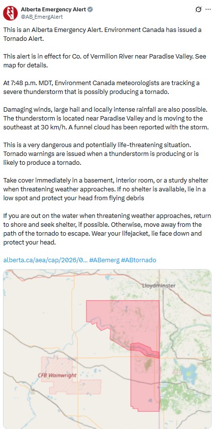
Why a warning is more serious than a watch
A warning is not a watch, and the difference matters tonight. A watch means conditions are favourable for a tornado to form. A warning, like this one, means a storm is producing a tornado or is likely to. Environment Canada notes that tornadoes can develop with less than half an hour of notice, which is exactly why a warning is a cue to take cover immediately rather than keep watching the sky.
What to watch for as the storm moves in
Storms can outrun the official alerts, so it helps to know the signs. A greenish or very dark sky, a low and rotating wall of cloud, a sudden calm followed by a hard shift in wind, or a loud, continuous roar are all reasons to get to shelter without waiting for another notification. A funnel cloud that reaches the ground is a tornado, but by the time you can see it, you should already be sheltering. Hail often falls just ahead of the most intense part of a storm, so large hail is a signal that worse may be right behind it.
This is part of a wider severe-weather day across Alberta
Tonight's warning is not happening in isolation. Much of Alberta was under a severe thunderstorm watch through the day on July 8, with storms firing along a warm front and tracking east toward Saskatchewan into the evening. Forecasters expect the tornado potential to ease overnight as the storms move east, but the same system is expected to organize into a larger line capable of damaging winds as it crosses into Saskatchewan, with areas near Regina and Saskatoon in view later tonight.
Alberta has had an active severe-weather season, with a run of confirmed tornadoes already this year, most of them weaker landspouts that caused no damage. Whether tonight's storm produces a confirmed tornado will be something the Northern Tornadoes Project and Environment Canada assess in the days after, once ground surveys can be done.
How to stay informed
The Alberta Emergency Alert system pushes these warnings directly to phones, and you can check current watches and warnings any time at weather.gc.ca. If you spot severe weather yourself, Environment Canada takes reports at 1-800-239-0484 or on X with the hashtag #ABStorm.
This is a developing situation. We will update this story as Environment Canada issues new information.
Sources:
Alberta Emergency Alert, tornado warning for Co. of Vermilion River near Paradise Valley, July 8, 2026 (emergencyalert.alberta.ca)
Environment and Climate Change Canada, tornado warning and severe thunderstorm warning for the Lloydminster area, July 8, 2026 (weather.gc.ca)







Comments
Conversation