Calgary has closed its rivers. Canmore has declared a state of emergency. Kananaskis has declared a state of emergency. Highway 40 has multiple washouts and bridge failures. Landslides have closed Highway 93 North in Banff National Park.
All of this is happening four days before the Calgary Stampede opens.
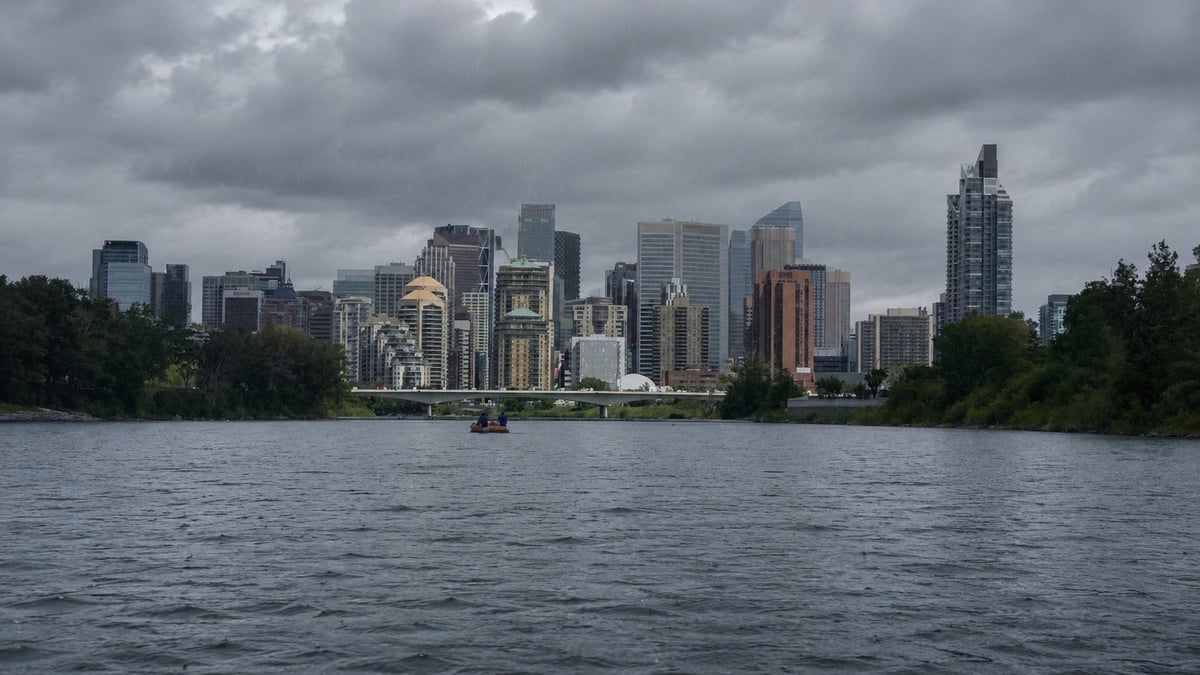
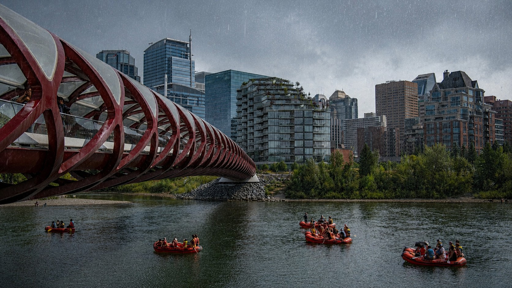
The Calgary Fire Department issued a River Safety Advisory on June 29 ordering all Calgarians off the Bow and Elbow Rivers immediately no boating, floating, swimming, or walking near the banks. The advisory covers pathway users, dog walkers, cyclists, and anyone near the water. It is expected to remain in effect through Canada Day and potentially to the end of the week.
"We know that Calgarians love their rivers, and as we head into the Stampede, we welcome lots of visitors, so we want to remind everyone that when our waterways flow this high and fast, there's significant risk, regardless of your watercraft or skill level," said Alex Kwan, Calgary Fire's Public Information Officer. "Those walking near our city's rivers, including people with pets, should be careful as well."
What the rivers are doing
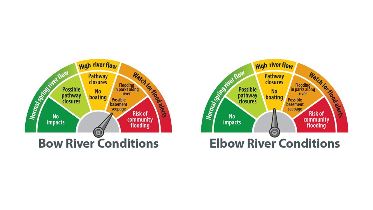
The Bow River advisory threshold is 280 cubic metres per second. Normal flow for this time of year is approximately 150 cubic metres per second. The Elbow threshold is 50 cubic metres per second. Both rivers have exceeded their thresholds.
Cold water, increased turbidity making hazards invisible below the surface, heavy debris including uprooted trees and branches, and the risk of being pinned against bridge pillars if swept away are the specific conditions that triggered the advisory. Widespread overbank flooding within Calgary is not expected — reservoir management on both rivers is actively controlling flows. But localized flooding on low-lying pathways is already happening. Check calgary.ca/pathwayclosures before heading out.
What is happening west of Calgary
This is where it gets serious.
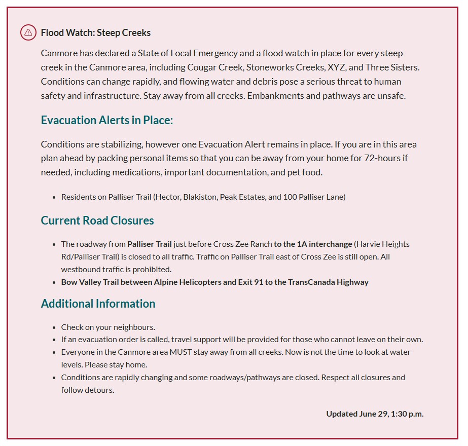
The Town of Canmore declared a state of local emergency on June 29. A flood watch is in place for every steep creek in the Canmore area — Cougar Creek, Stoneworks Creek, and Three Sisters among them. Evacuation alerts are active for residents on Palliser Trail, Eagle Landing, Stone Creek Road, the Alpine Club, Bow Valley Riders Association, and Lincoln Park to Alpine Helicopters. Roads including Palliser Trail from Palliser Lane to the 1A Interchange are closed to all traffic.
The Town said peak rainfall ended at approximately 9 p.m. Sunday. "Good news: we have made it through the worst of the rain," Canmore said in a statement at 6 a.m. Monday. But evacuation alerts remain in place and significant erosion has left creek banks unstable and unsafe. "Stay away from Cougar Creek and all other steep creeks until the areas have been cleared for safety," the Town said.
The Kananaskis Improvement District also declared a state of local emergency on June 29. Emergency teams activated the Kananaskis Region Emergency Coordination Centre. Crews are responding to multiple mudslides and bridge washouts across the region. William Watson Lodge is available as a temporary shelter for anyone in the area who needs it.
The highway closures
Highway 40 is closed from Mount Lorette Ponds to Highway 940. Mount Allan Drive at the Kananaskis River is closed in both directions due to a road breakup at the bridge. There is a bridge washout at Highway 40 at Evan-Thomas Creek. A landslide is blocking the road just north of Highwood Pass.
In Banff National Park, a landslide has closed Highway 93 North in both directions near Mosquito Creek. Additional landslides are blocking lanes approximately three to five kilometres south of Mistaya Canyon and about 10 kilometres north of Silverhorn Campground.
Anyone in Kananaskis who cannot leave due to road conditions is being asked to shelter in place.
How this compares to 2013
At peak flows in 2013 the Bow River was running at approximately 1,500 to 1,600 cubic metres per second through Calgary. Current flows are well above advisory thresholds but significantly below 2013 flood levels. Calgary has also invested heavily in flood mitigation since 2013 — the Springbank Off-Stream Reservoir is now operational protecting Elbow River communities and the Memorial Parkway Sunnyside Flood Barrier protects Sunnyside, Kensington, and Hillhurst. The city says these investments have reduced Calgary's flood risk by 70 percent as of 2026.
This is not 2013. But it is serious enough to close both rivers, shut down major mountain highways, and force two emergency declarations before Canada Day.
What to do
Stay off the Bow and Elbow Rivers. Keep pets back from the water. Watch for submerged pathway sections. Avoid non-essential travel to Kananaskis Country — some people already there cannot leave. Check calgary.ca/watersafety, calgary.ca/flood, and calgary.ca/pathwayclosures for current Calgary conditions. For Canmore updates visit canmore.ca/emergency. For Kananaskis closures check 511 Alberta at 511.alberta.ca.
Sources:
City of Calgary Newsroom, Calgary Fire Department issues river safety advisory, June 29, 2026 (newsroom.calgary.ca)
City of Calgary, River flooding page (calgary.ca/water/flooding.html)
Town of Canmore, State of local emergency declaration and emergency page (canmore.ca/emergency)
Kananaskis Improvement District, state of local emergency declaration, June 29, 2026
Alberta Parks, Kananaskis Country closure advisory, June 29, 2026 (albertaparks.ca)