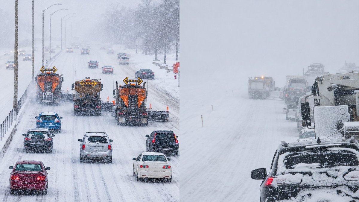
Southern Alberta is getting hit with heavy snow overnight, and it isn’t stopping until Wednesday evening.
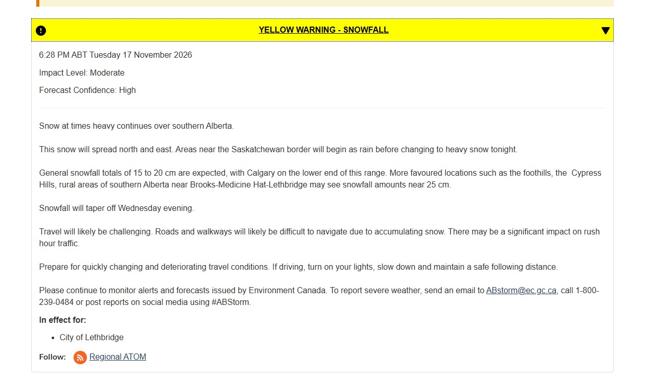
Environment and Climate Change Canada has a snowfall warning in place across southern Alberta, from the foothills east to the Saskatchewan border and south to the U.S. line. Its latest update, issued at 6:28 p.m. Tuesday, calls for 15 to 20 cm across the warning area, with Calgary at the lower end.
The southeast gets the worst of it. Environment Canada says rural areas near Lethbridge, Medicine Hat and Brooks could see close to 25 cm, along with the foothills and the Cypress Hills.
It’s a sharp turn. On Monday, Medicine Hat was the warmest place in Alberta, at 15.5 C.
How much snow, and where
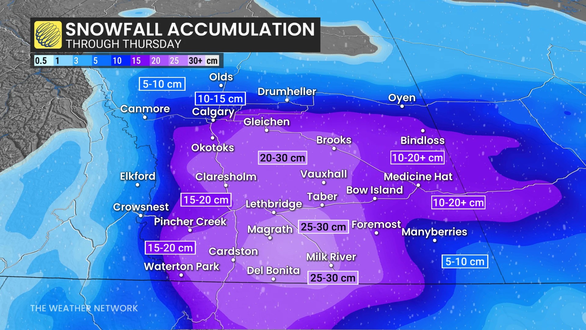
The two main forecasts agree on where the worst of it lands. They differ on how much.
Environment Canada says close to 25 cm in the hardest-hit rural areas.
The Weather Network goes higher. It’s calling for 20 to 30+ cm in Lethbridge, Brooks, Taber, Cardston, Milk River and the surrounding areas, with up to 40 cm possible in a few spots.
Lethbridge averages 16.4 cm of snow in all of November, The Weather Network says. Even the low end of these forecasts puts the city on track for more than a month’s worth in about a day.
Amounts will vary a lot within the warning area. The higher numbers are for the hardest-hit spots, not every town.
Lethbridge: heavy snow all night and most of Wednesday
Environment Canada’s Lethbridge forecast:
Tuesday night: Snow, heavy at times. Around 0°C. North wind 20 km/h, gusting to 40.
Wednesday: Snow, heavy at times, through about 5 p.m. Near 0°C, with wind chill around -6 or -7. Northwest wind 20 km/h, gusting to 40.
Wednesday evening: Snow eases to a 60 per cent chance of flurries, and the wind drops after 8 p.m.
Most of the snow falls tonight, so expect the deepest accumulation by morning. More keeps coming through the day.
Medicine Hat: the changeover comes later
Medicine Hat starts with rain before switching to snow.
| When | Forecast | Snow |
|---|---|---|
| Tuesday night | Rain or flurries, turning to heavy snow after midnight. Northeast wind 20 km/h, gusting to 40. Low of 0°C. | 5 to 10 cm |
| Wednesday | Heavy snow. North wind 20 km/h, gusting to 40. High near 0°C. | 10 to 15 cm |
| Wednesday night | Snow ending near midnight. Risk of freezing drizzle and fog. Low of -5°C, wind chill -8. | Not specified |
| Thursday | Cloudy, 30 per cent chance of flurries. High of 1°C. | |
| Friday | Cloudy. High of -2°C, low of -7°C. |
That adds up to 15 to 25 cm for the city by Wednesday night. Snow in Medicine Hat is forecast to last until near midnight, later than the regional warning’s “Wednesday evening.”
Brooks, Taber and the rest of the south
The warning covers the Brooks, Strathmore and Vulcan region, the Medicine Hat, Bow Island and Suffield region, and the Lethbridge, Taber and Milk River region, along with the rest of southern Alberta.
Brooks is one of the communities Environment Canada flagged for the highest totals. The Weather Network includes Taber, Cardston and Milk River in its 20 to 30+ cm zone.
Why it’s piling up so fast
The air and ground are already soaked after the rain, and temperatures drop just below freezing overnight. That makes for fast-building, wet, heavy snow, The Weather Network says.
Wet snow is harder to shovel. It packs into ruts on side streets and turns to ice once temperatures drop. Take it slow if you’re clearing a long driveway.
Wednesday morning is the worst time to drive
Environment Canada says roads and walkways “will likely be difficult to navigate due to accumulating snow” and there “may be a significant impact on rush hour traffic.”
The Weather Network expects very slick roads and major delays by Wednesday morning, with dangerous travel likely on the QE2 and Highway 3 during the morning commute. In the southeast, wind gusts of 40 to 50+ km/h Wednesday morning will cut visibility on open highway.
If you have to drive:
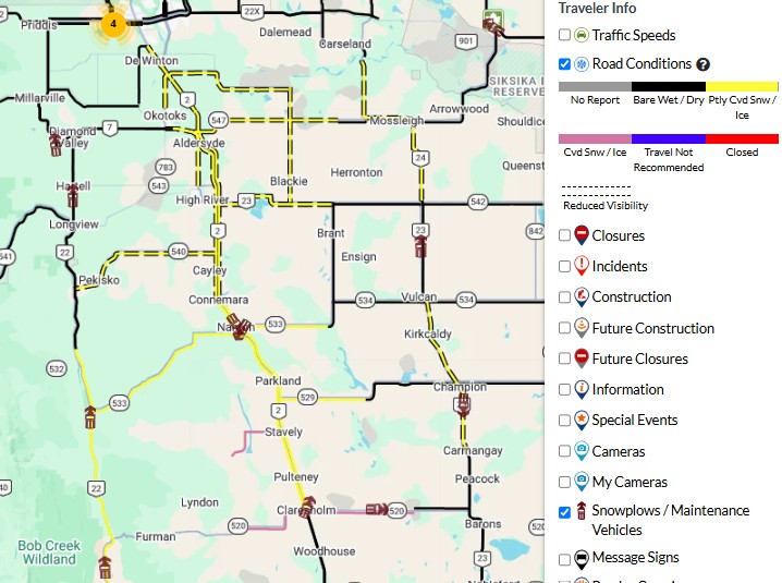
Check 511 Alberta for the stretch you’re driving. Its map shows road conditions, cameras, collisions and closures. Watch for snow- or ice-covered sections and anything marked “travel not recommended.”
Turn on your lights, slow down and leave lots of space, as Environment Canada advises.
Pack a winter kit for rural highways: a blanket, water, a phone charger and a shovel.
Wait if you can. Snow is still falling during the day Wednesday, so later in the morning isn’t automatically better. Check the forecast before you go.
Lethbridge: watch for snow route notices
A snowfall warning doesn’t automatically start Lethbridge’s snow route parking ban. The City announces it separately when crews need routes cleared, and gives 24 hours’ notice to move vehicles.
You can check the snow route map and plow tracker at lethbridge.ca/snow, or turn on service alerts in the Lethbridge Loop app. The City’s winter page also links to Whoop-Up Drive traffic cameras, useful before you cross the river.
The snow stops, the ice doesn’t
When the snow ends Wednesday night, the risk doesn’t. Medicine Hat’s forecast calls for possible freezing drizzle and fog overnight, with a low of -5°C.
That means freshly plowed roads and cleared sidewalks could ice over by Thursday morning. Highs stay near or below zero through Friday.
Calgary and central Alberta
Calgary is at the lower end, with about 15 cm. We broke down Calgary’s forecast, the commute and the city’s shovelling rules.
Central Alberta, including the Red Deer, Stettler, Drumheller, Hanna and Oyen areas, is under a special weather statement rather than a warning. Expect 5 to 10 cm there.
The storm moves into southern Saskatchewan on Wednesday, so if you’re driving east, expect similar conditions across the border.
Forecasts change. This article reflects Environment Canada’s warnings issued at 6:28 p.m. Tuesday, Nov. 17, 2026, and The Weather Network’s forecast published at 7:47 p.m. Snowfall amounts are predictions, not measured totals.





Comments