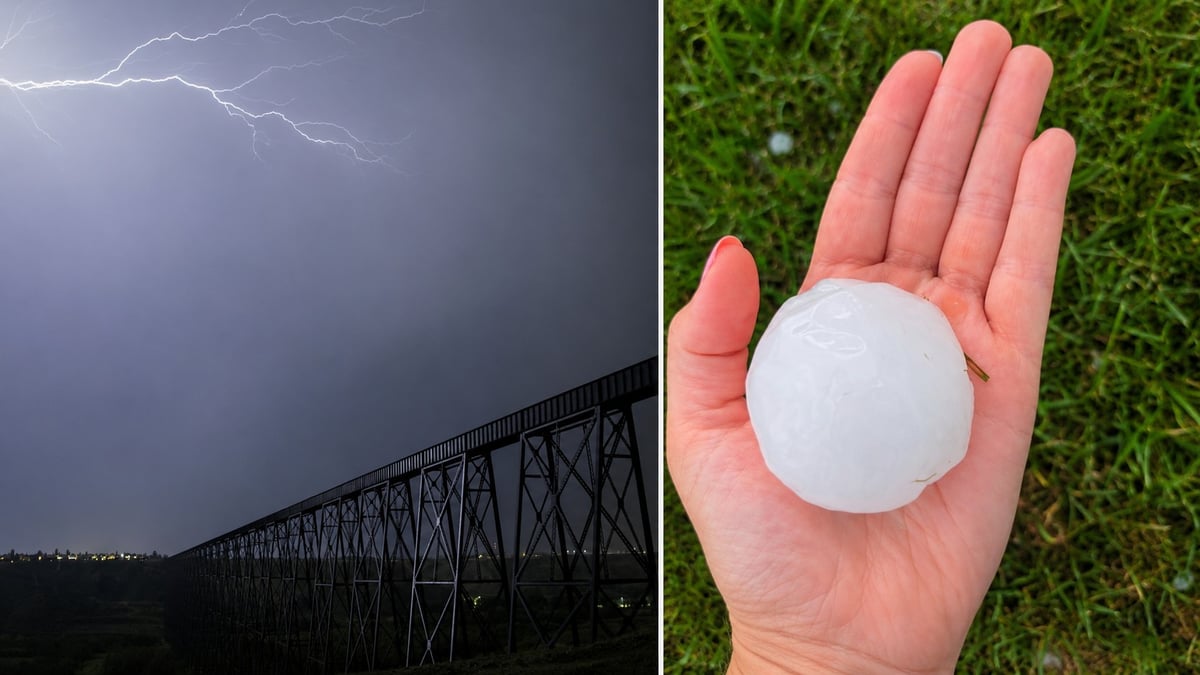
Environment Canada issued red alerts across southern Alberta on Tuesday evening, warning of baseball size or greater hail from extremely dangerous thunderstorms.
Claresholm took a direct hit.
The alerts
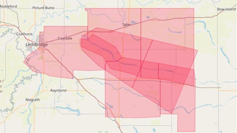
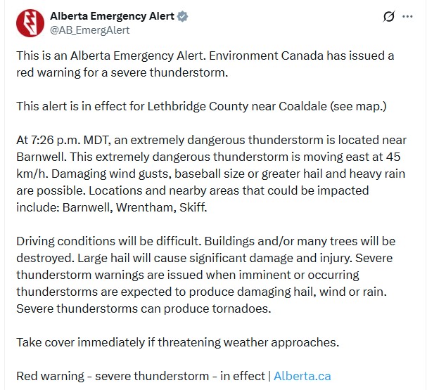
At 7:26 p.m. MDT, a red warning was issued for Lethbridge County near Coaldale. An extremely dangerous thunderstorm was located near Barnwell, moving east at 45 km/h, with Barnwell, Wrentham and Skiff listed as areas that could be impacted.
A separate red alert covered the MD of Willow Creek near Claresholm and Stavely, listing Claresholm, Nobleford and Monarch.
Both carried the same warning language. Damaging wind gusts, baseball size or greater hail and heavy rain possible. Buildings and many trees will be destroyed. Large hail will cause significant damage and injury.
By 8:48 p.m., Environment Canada was tracking a severe thunderstorm near Foremost, southeast of Lethbridge, still moving east at 45 km/h. An orange watch remained in effect across the surrounding area, including Lethbridge and Fort Macleod.
What actually hit
A severe thunderstorm pounded Claresholm and the surrounding area. Claresholm sits about 120 kilometres south of Calgary.
Around Coaldale, residents reported destroyed gardens and flower beds, with hail described as roughly marble-sized rather than the baseball size the warning allowed for.
Reports from Lethbridge varied sharply by neighbourhood. Some residents described significant hail, while others a few kilometres away said nothing fell at all. Early in the evening, people on the west side, south side and east end reported clear skies while Coaldale was already taking damage.
Environment Canada had not published verified hail measurements at the time of writing.
Why the red alert said baseball and your street got nothing
This frustrates people every summer and it isn't a failed forecast.
A warning describes what a storm is capable of producing, not what will land on a particular street. Radar can identify hail of a given size being carried aloft. It cannot say which quarter sections will be under the core when that hail comes down.
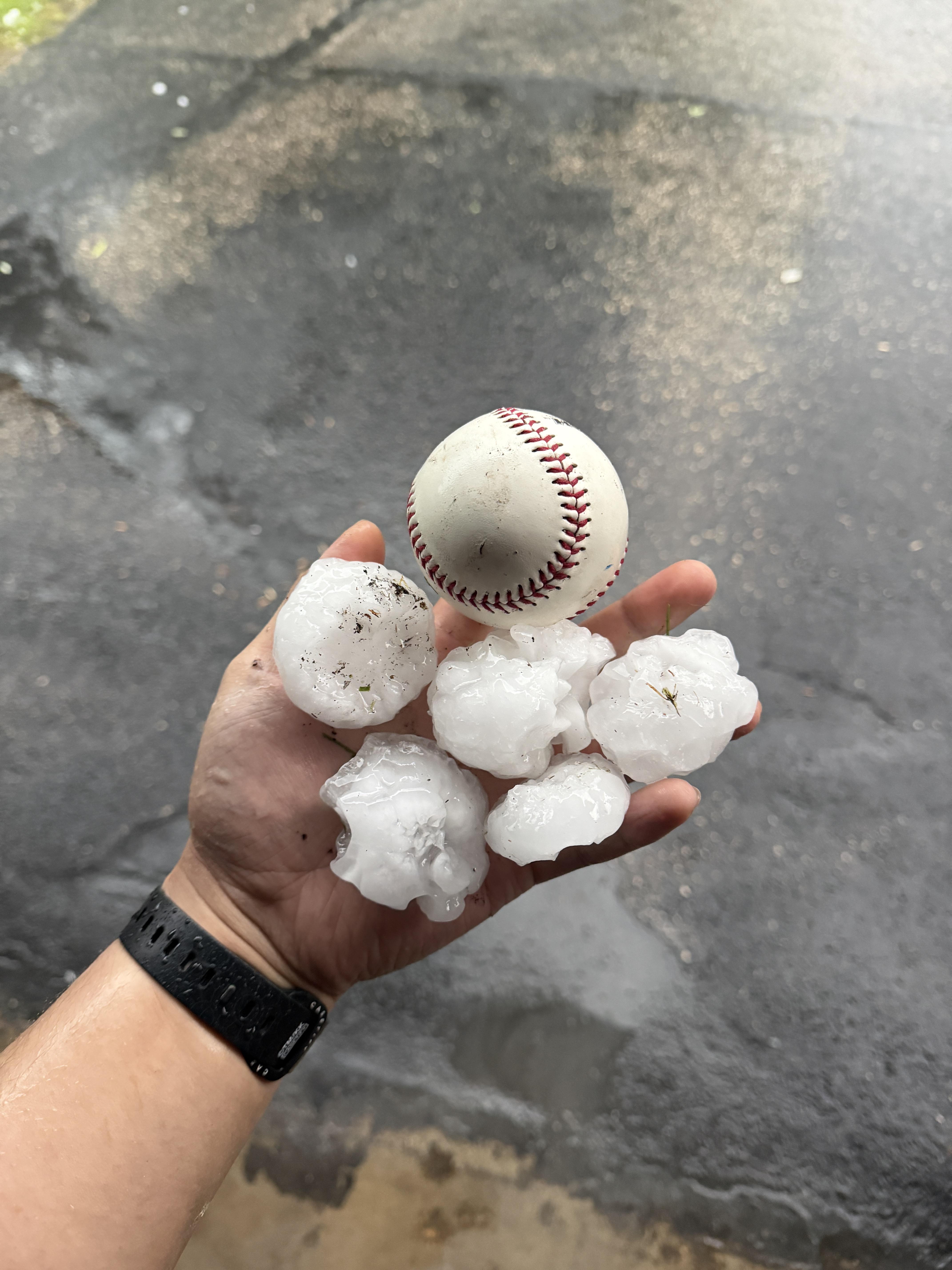
Hail cores are narrow. A storm can drop 70-millimetre stones on one farm and nothing three kilometres away. That's why Claresholm was pounded, Coaldale lost gardens, and most of Lethbridge saw an ordinary August evening.
Environment Canada has been working to target its warnings to more specific areas for exactly this reason. The colour tiers are part of that. A red warning is the most serious level, reserved for storms considered extremely dangerous. A yellow warning is the standard severe thunderstorm warning. An orange alert is a watch, meaning conditions are favourable but nothing has been confirmed.
Getting a red alert and no hail is the system working.
It wasn't just the south
The Weather Network described a stationary boundary over the Rockies triggering severe storms across Alberta through Tuesday afternoon and evening, with the threat spanning from Grande Prairie to the international border, including Edmonton, Red Deer, Calgary, Claresholm, Okotoks and Lethbridge.
Storms kicked off along the foothills in waves through the afternoon and tracked east into the evening. The morning forecast called for damaging hail up to ping-pong ball size. The red alerts issued later escalated that.
The system is part of the pattern change that ended July's ridge over southern Alberta, replacing hot and dry conditions with days of instability and a cooldown.
If you took damage
Photograph everything before you clean up. Roof, siding, windows, screens, and any vehicle parked outside.
Hail damage to a vehicle is covered under comprehensive insurance, which is optional in Alberta. Liability and collision alone will not cover it.
Check whether your home policy pays replacement cost or actual cash value on a roof. Some depreciate, and the difference can run into thousands.
Garden and landscaping losses generally aren't covered, though some policies include limited fence or outbuilding coverage.
Call your insurer early. Claim queues after Alberta hailstorms fill quickly.
Roof damage you won't see yet
Hail damage to asphalt shingles often isn't visible from the ground and doesn't leak immediately. It surfaces the following spring as water in a ceiling.
If your area was hit, get an inspection while the damage is fresh and the cause is easy to attach to a date.
Be careful with door-knocking contractors after a hail event. Alberta sees a wave of them every summer. Ask for a business licence, a local address and references, and don't hand an insurance cheque to someone you met that afternoon.
For producers
Crop damage from hail in the Claresholm, Nobleford and Monarch corridor and around Barnwell should be reported to your insurer as soon as possible.
Agriculture Financial Services Corporation administers crop insurance in Alberta, and hail endorsements have their own reporting requirements and timelines. Damage assessment is easier before a field is worked.
Report what fell
Environment Canada depends on public reports to confirm actual hail sizes, and those reports feed the forecasting record.
Email ABstorm@ec.gc.ca, call 1-800-239-0484, or post with #ABStorm. A photo with a coin or a hand for scale beats a description.
Did you get hail Tuesday night? Send us your photos and tell us where you were. We'll add them to this story.
Power and safety
Report outages and downed lines to FortisAlberta at 310-WIRE. Treat every downed line as live and call 911 if anyone is near one.
Photograph spoiled food before throwing it out and note your outage times.
Current alerts are at weather.gc.ca and emergencyalert.alberta.ca.
Sources
Alberta Emergency Alert, red warnings, August 11, 2026
Environment and Climate Change Canada, severe thunderstorm warnings and watches
Agriculture Financial Services Corporation, crop insurance reporting
Claresholm damage as reported by CBC News. Claresholm-area red alert details as reported by Lethbridge News Now. Provincial storm setup as reported by The Weather Network.








Comments
Conversation